


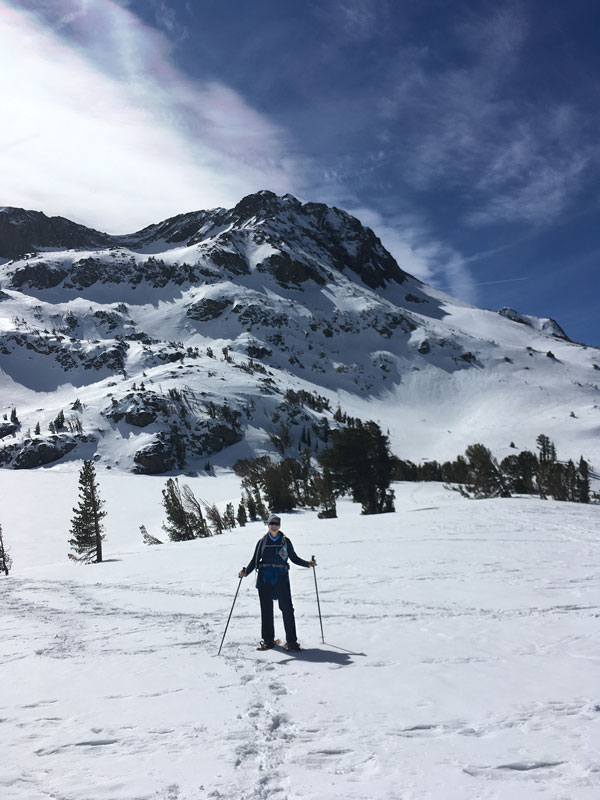
While I love flowing over the snow on cross-country skis, there is something especially relaxing about the slower pace of a day touring the wilderness on snowshoes. Especially, if that day is spent at one of the prettiest places in the Sierra: Carson Pass. From the Pacific Crest Trailhead at 8,600 feet in elevation, it’s a 4-mile round trip jaunt with a couple hundred feet of climbing to the edge of frozen Winnemucca Lake.
We could see the wide frozen expanse of Winnemucca Lake, tucked up tight against the massive rock that is Round Top peak just to our south. To the west, frozen Caples Lake. In the near distant northeast, Freel Peak, Tahoe’s highest peak, sits on the same ridge as Job’s Peak and Job’s Sister.
We picked a gorgeous midweek day to make the trip from the North Shore to Carson Pass. The journey through Hope Valley and the climb to the Sierra divide at the pass is almost as much fun as getting out of the car and heading onto the snow. Carson Pass is just shy of 9 miles west of the intersection of Highways 89 and 88. As you crest, the pass, the parking lot and summer information center appears immediately on your left. If you have a Sno-Park season pass you are all good. If not, you need to go online ahead of time and purchase one. They are just $6.75. The trailhead is first-come, first-served, and certainly on a busy weekend it will fill up, so don’t dilly-dally.
Read about Winnemucca Lake’s summer explosion of wildflowers
The route to Winnemucca Lake begins by somewhat following the Pacific Crest Trail. But since a ton of snow sits on the trail, you are never really sure whether you are on the trail or not, but as Bill Murray says in the movie “Meatballs”, “It just doesn’t matter.” We followed the clearly packed track that lots of other snowshoers had created, and also brought Gaia mapping software just in case. If it recently snowed and no one else has packed down the trail, be sure to bring mapping software and head pretty straight south toward Round Top, the dominant feature that will appear anytime you emerge from the trees. Better yet, pick a nice day at least a few days after the most recent snows to enjoy the fruits of other snowshoers’ labors.
The Trail
4-miles roundtrip | Moderate
Sno-Park pass required; ohv.parks.ca.gov
The first mile is through a scattered high altitude forest of juniper, western white pine, hemlock and lodgepole. If you like large and interesting trees this trip will provide. We encountered some of the largest and healthiest looking lodgepole I’ve seen, as well as some extraordinary junipers holding on to life in the rocky crags.
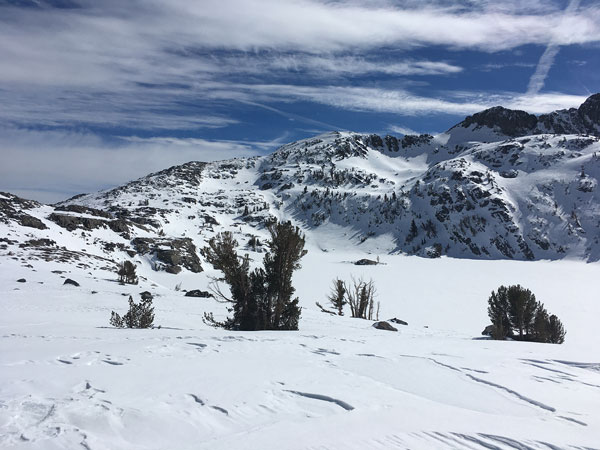
After about a mile, the route lifts away from the forest and into a wide open expanse of snowy goodness. To the east sits the rounded top of Elephant’s Back, mostly black as the snow has blown off. To the south, Round Top sites majestically above the snowy slope with the Three Sisters taking up the ridge to its right. Once we had climbed to the shore of Winnemucca Lake the views became sublime and we found a perfectly placed flat rock that made for a great lunch spot.
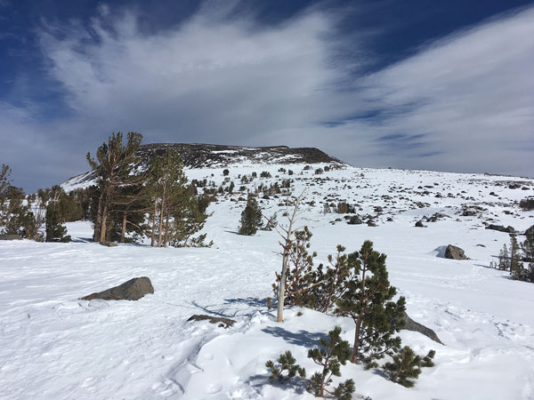
From here we could see the wide frozen expanse of Winnemucca Lake, tucked up tight against the massive rock that is Round Top peak just to our south. To the west, frozen Caples Lake. In the near distant northeast, Freel Peak, Tahoe’s highest peak, sits on the same ridge as Job’s Peak and Job’s Sister. In the far distance, you just glimpse the ridges behind the northern end of far off Lake Tahoe. Speaking of Lake Tahoe, Red Lake Peak dominates the view just north of Highway 88. It is best known as the place John C. Fremont and his guide Kit Carson climbed and saw a distant mountain lake, becoming the first Europeans to see Lake Tahoe.
While enjoying the impossibly blue sky we watched a back-country skier descend down the steep bowl coming down from Round Top. Then about three-quarters of the way to the top the skier stopped and took a long break while we speculated whether he was Ok, but then realized, he must have just been enjoying lunch like we were, but with an even more spectacular view that most likely included Lake Tahoe, as well.
Lunch ended as the afternoon wind arrived and the chill got us off our butts to head on out. We stopped at a viewpoint halfway back and pondered Round Top one last time. I’ve enjoyed this hike in the summer many times because of the prolific midsummer wildflower show it provides, but the vast expanse of deep snow tucked up against the Sierra crest peaks is just as spectacular.
From North Tahoe, it’s right at an hour and a half to Carson Pass. South Shore folks can be there in just 40 minutes. Don’t forget your parking permit.
If you are not a regular snowshoer, remember, snowshoe miles are slower and harder than hiking or cross-country skiing miles. Carson Pass is an area that gets a ton of snow making this section of Highway 88 one of the worst avalanche zones in California. The road frequently closes for snow removal, so don’t attempt this trip during or immediately after a snowstorm. Visit sierraavalanchecenter.org to check the avalanche forecast before visiting.


