


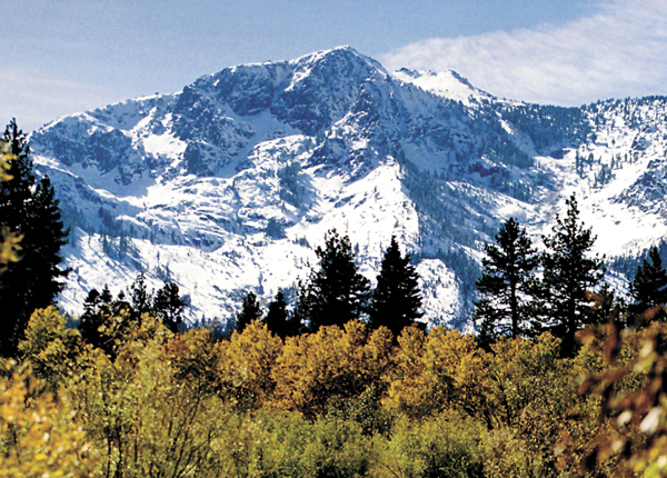
When we start thinking about the upcoming winter season, it’s usually triggered by familiar signals: longer nights, cooler temperatures, leaves changing color and the sound of chopping wood. This year, however, there was nothing subtle about the extraordinarily powerful atmospheric river that tore into northern California and the Tahoe Sierra recently. The unprecedented intensity of the rain crushed historic daily rainfall records from San Francisco to Reno, Nev. After back-to-back anemic winters, the early mountain snowfall has really jacked up enthusiasm for winter sports in 2022.
The beneficial precipitation effectively ended the disastrous 2021 fire season for Northern California and raised Lake Tahoe’s water level 6 inches above its natural rim.
With a mild, subtropical moisture tap, high-freezing levels initially limited snow accumulation below 7,500 feet in elevation, but as the storm progressed snow levels dropped. For those keeping track, at the Central Sierra Snow Lab near Donner Pass, the nearly 48 inches of snowfall measured for October 2021 was just shy of the modern record of 49.6 inches from 2004. Some of that October snow fell during a vigorous cold storm earlier in the month, well before the atmospheric river onslaught. In October 2004, Mammoth Mountain Resort set a local benchmark of 86 inches of snow. Currently, 2021 and 2004 represent the two top snowiest Octobers at the lab since it was established in 1945.
October’s gnarly storms
Before 1945, Southern Pacific Railroad started taking snowfall measurements in January 1878 at its Norden station near Donner Pass. Those data indicate that many Octobers have been hit with decent snowfalls in the 2- to 4-foot range, the greatest being an incredible 89 inches (7.4 feet) in 1899. That October was a cold and stormy month.
Truckee is often shadowed out from the heaviest accumulations above 7,000 feet, but in 1899 railroad employees recorded an impressive 50 inches of snow downtown. Many historians and authors refer to the Donner Party wagon train getting blocked by 5 feet of snow on Donner Pass in late October 1846. They often make it seem as though it was a once-in-a-lifetime event and that it hasn’t snowed that much since that tragedy. Well, now you know. October can still be gnarly.
Exceptional Atmospheric River
Last month’s Category 3 Atmospheric River was exceptional for any time of year, but especially for October, a relatively calm month climatologically. The intense rainfall was precedent setting with long-standing one-day and monthly precipitation records shattered throughout the state.
Sacramento picked up 82 percent of its total 2021 water year in just 24 hours. The National Weather Service reported that a new 24-hour rainfall record was set at the state capital with 5.44 inches, exceeding the one-day tally of 5.28 inches from April 20, 1880. But according to rainfall measurements taken at that time by Sacramento Signal Service officer M.M. Sickler, the actual amount was 7.24 inches, meaning that the 1880 record still stands. April 1880 was exceptionally wet. Storms that month dumped nearly 25 feet of snow on Donner Pass, still the all-time April record.
Record-setting precipitation storm totals in Tahoe Sierra communities ranged between 5 to 8 inches. An exception was Incline Village, Nev., with less than 3 inches of water, which included 18 inches of snow. The real outlier was Glenbrook, Nev., on the East Shore with just more than 1 inch of rain. Reno-Tahoe International Airport received more than double that in just one day.
On the routinely wetter Sierra west slope, Grass Valley was deluged by more than 9 inches of rain in 24 hours, a new record for that Gold Rush town. Not to be outdone, Blue Canyon set an all-time, one-day record of 10.40 inches by eclipsing the previous record of 9.33 inches from Dec. 22, 1964. The amount of rain was epic, but the risk of major flooding was diminished by dry soils, empty reservoirs and the lack of a pre-existing snowpack to rapidly melt, a common trigger for mid-winter hydrologic events. The beneficial precipitation effectively ended the disastrous 2021 fire season for Northern California and raised Lake Tahoe’s water level 6 inches above its natural rim.
2020-21 was third driest
The remarkable amounts of rain that fell in October 2021 stands in stark contrast to the preceding water year that began on Oct. 1, 2020, and ended Sept. 30, 2021. Last year, the Tahoe Sierra was cursed by a lack of wet storms and few productive atmospheric rivers that frequently produce up to 50 percent or more of our winter precipitation. The spring runoff in 2021 was nearly nonexistent due to extremely low water content in the mountain snowpack, coupled with parched soils that absorbed all the water before it ever reached lakes and reservoirs for storage.
Based on the Northern Sierra Precipitation, 8-Station Index, the total of 23.28 inches of precipitation tallied last year was only 44 percent of average, which ranks as the third driest in 100 years. More specifically, the Central Sierra Index of 5 stations totaled just 18.35 inches, 43 percent of normal and ranked as second driest in recorded history.
Quick on the heels of that markedly dry rainy season was record-breaking heat with the fourth hottest June in northern California; South Lake Tahoe set many new daily record high temperatures that month and into July. The summer of 2021 ranks among the top five for warmest and driest on record, a trend that only exacerbated devasting and ongoing forest fires.
In Sacramento, it was the fourth hottest June since 1877, but the heat only increased moving into true summer. During a July heat wave the temperature reached a scorching 113 degrees, just one degree shy of the city’s record of 114 on July 17, 1925. The combination of back-to-back dry winters and blistering heat drove California’s central valley into exceptional drought territory, the most extreme ranking in the U.S. Drought Monitor.
What’s in store?
What’s in store for winter 2022? Well, no one really knows, but that doesn’t stop scientists from generating seasonal forecasts based on current and expected oceanic and atmospheric environments. There is a confusing alphabet soup of oscillations that affect the planet’s weather: Arctic and Antarctic Oscillations, Pacific Decadal Oscillation, ENSO (El Niño/La Niña Southern Oscillation), etc.
For the second year in a row, weather on the Pacific Coast is forecast to be affected by a moderate strength La Niña event. It’s not unusual to have consecutive ENSO negative ocean conditions where subtropical sea-surface temperatures are below normal. Since 1950, eight of the last 12 ENSO negative events lasted two years. Based on expected La Niña conditions, the Climate Prediction Center’s seasonal outlook is again calling for wetter than normal precipitation for the Pacific Northwest and drier than average rain for Southern California with slightly above-average temperatures for the Tahoe Sierra. But no matter how you slice it, water year 2022 is off to an amazing start.


