


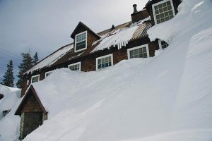
It’s that time of year again when weather prognosticators are peering into their tea leaves to try and discern what the Storm King has in store for Lake Tahoe ski resorts this winter. Long-range forecasts for 2014 are all over the map and to most professional meteorologists just a stab in the dark.
Despite significant advances in computer modeling over the past decade, producing an accurate three- or four-month seasonal forecast for temperature and precipitation for any given location is still mostly just an educated guess. When it comes to economics for our local resorts, when snow falls is at least as important as how much they get in total.
A long-range outlook with broad-brushed features for California can be enhanced if the Pacific Ocean is showing the pronounced sea surface cooling and heating associated with an El Niño Southern Oscillation, but ENSO-neutral conditions are expected for the winter of 2014. Of course, the venerable Old Farmer’s Almanac, which publishes seasonal forecasts for 16 regions of the United States, is predicting a cold winter season for most areas east of the Rockies. It also is calling for greater than normal snowfall in the Sierra with January and February being the stormiest months. The Almanac (OFA) claims a historic accuracy rate of 80 percent, but Bay Area meteorologist Jan Null’s occasional evaluations of the OFA illustrates that the publication often does a poor job in its weather predictions.
Tahoe resorts focus on snow, but water is our region’s most important environmental commodity. Sept. 30 marked the end of the 2013 water year, making it an appropriate time to look back to see where last winter stands water-wise. Officially, the 2013 water year ended on June 30 for California’s coastal regions and interior valleys. The lowlands calculate annual precipitation based on a July 1 to June 30 calendar cycle. In the Sierra, however, the water year runs from Oct. 1 to Sept. 30. Early October is traditionally the time of year when reservoir storage and stream flow are at their lowest levels. It’s also the time of year when winter sports enthusiasts start getting itchy for snow.
It may seem counterintuitive to those who remember how last winter suffered from an extraordinarily long period with little snowfall, but the 2013 water year came in at an impressive 92 percent of average for the Northern Sierra Precipitation Index. This eight-station index includes precipitation gages from Mount Shasta City south through Blue Canyon (Interstate 80) and Pacific House (Highway 50). Considering the erratic nature and annual variability of Sierra winters, precipitation values within 10 percent of average should be considered within the normal range.
It’s easy to forget that the 2013 winter season started off with drenching rainstorms that initially put the region on pace to exceed the Northern Sierra’s wettest winter of record (1983). At the Central Sierra Snow Laboratory near Donner Pass, hydrologist Randall Osterhuber measured a total of 45.7 inches of precipitation in 2013, a respectable 89 percent of normal. (Precipitation is rain and snowmelt combined.) On the other hand, only 215 inches of snow fell there, a measly 53 percent of average. At the Snow Lab, the winter of 2013 was the fifth least snowiest since 1878. Squaw Valley tallied a season total of 326 inches of snow at its upper mountain stake located at 8,200 feet, which is more than 1,000 feet higher in elevation than the Snow Lab.
This is how crazy the 2013 winter turned out. In the Northern Sierra, November and December was the ninth wettest of record for the two months combined. Higher snow levels limited substantial accumulations to the upper elevations that laid down a healthy base for the upcoming ski season. During the Christmas-New Year holiday vacation, a series of cold, powerful storms delivered more pow for skiers and boarders. By New Year’s Day, Squaw Valley’s upper slopes had picked up nearly 21 feet of snow. And, even the lower mountain, which had lost much of its base during an earlier rain event, had received another 12 feet of snow. It was the best start to a winter since the epic 2011 season, which ranks as the ninth snowiest of record at the Snow Laboratory.
But then, in a stunning weather pattern reversal, the next three months — January, February and March — were the driest on record for the region. With the storm door slammed shut, Pacific weather systems detoured around the Tahoe Sierra. It was an unprecedented dry spell for the Tahoe-Truckee region. Tahoe City received only 2.68 inches of water during the period — statistically the wettest time of year that averages more than 16 inches of precipitation — which set a new record as the driest three-month stretch since measurements began in 1910. Similar conditions plagued much of Northern California. The San Francisco Bay Area picked up about 50 percent more rain than normal in November and December of 2012, but San Francisco’s January through April rainfall total of 3.32 inches was the least amount since measurements began in the 1849 gold rush.
Statewide, the Jan. 1 snowpack stood at a robust 140 percent of average for the date. By April 1, however, the time of year when the snowpack statistically reaches its greatest water content, surveys indicated a snowpack at only 42 percent of average. The winter had turned into a bust. Kelly Redmond of the Western Regional Climate Center said the extreme flip-flop was like Dr. Jekyll and Mr. Hyde.
With no strong ENSO signals in the Pacific Ocean this winter, the Climate Prediction Center has targeted California with an outlook for a normal range of temperatures and precipitation. The Climate Prediction Center admits that its forecast confidence is low due to the ENSO-neutral conditions, but since Lake Tahoe resorts normally pick up between 30 to 40 feet of snow in an average winter, normal would be good enough in 2014.
Weather historian Mark McLaughlin is a nationally published author and professional speaker. His award-winning books are available at local stores or at thestormking.com. You may reach him at mark@thestormking.com. Check out his blog at tahoenuggets.com.


