


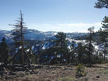
The view from the Johnson Canyon trail looking south toward Donner Summit. Hikers may see the railroad tracks and then Sugar Bowl in the distance ·
The south-facing, sunbaked bowl of Johnson Canyon is the perfect early season jaunt after a mild winter. The 4-mile round trip hike begins winding gently through granite boulders in an area that was consumed by an enormous wildfire some 50 years ago. It is now a land of Manzanita, buckthorn and tobacco brush, with scattered Jeffrey pines and firs.
While you might bemoan the lack of trees, all that open terrain makes for fast-melting snow and nice views. On a warm, mid-summer day, however, shade is in short supply. The trail travels up the open bowl, with a small stream to your left. Looking up, you can see your final destination, a ridgetop dotted with volcanic rock outcroppings and scattered trees.
The walking is pleasant, and on a sunny day will be invigorating. At the Donner Lake Rim Trail intersection, a left turn would take you to Summit Lake, and a junction with the Pacific Crest Trail at the top of Donner Summit. On a beautiful spring day, skip the higher and more snow-covered slopes of Donner Summit and stay on likely snow free terrain to your right.
Now, the climbing begins in earnest as the forest thickens and you walk through groves of red fir and Jeffrey pine, passing enormous volcanic knobs. While you are gaining a good bit of elevation, the trail includes a number of well-graded switchbacks making it only moderately difficult.
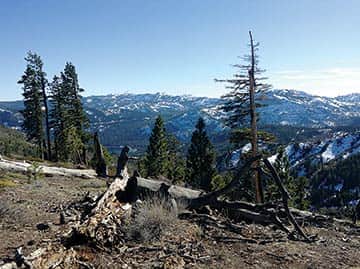
Tinker Knob may be seen in the distance between the trees, with Anderson Peak to the right near the ridge on the trail ·
The views of the snow-capped , keep getting better as you rise. Soon to the south, you see Tinker Knob, Anderson Peak, the train tunnels on Donner Summit and a hint of Donner Lake. To the northwest, Castle Peak, and the steep drop from Frog Lake Cliffs toward the unseen Frog Lake, attract your attention. And to the northeast, green and red lichen-covered black volcanic spires spur you toward the top. At the crest of the ridge, you might find snow, and the Drifter Hut.
Having skied there numerous times from Tahoe Donner Cross Country, I was pleasantly surprised how much easier it was to hike this trail to the top instead of ski it from the Tahoe Donner Lodge. From Drifter, be sure to take an easy stroll over to the northern edge of the ridge to look into Euer Valley.
From the top, you can just retrace your steps, having found a quick and fun jaunt into a less known part of the Truckee-Donner region.
While the trail is used frequently by hikers, dog walkers, runners and mountain bikers, it certainly is not as busy as the trails of Desolation Wilderness or along the Tahoe Rim Trail.
Donner Lake Rim Trail
The hike is part of the Donner Lake Rim Trail, which when completed will provide a 23-mile loop about Donner Lake. Most of the northern half of the trail is complete, but a long section above Donner Lake along the Schallenberger Ridge, and between Donner Lake and Glacier Way on the edge of Tahoe Donner, still need to be built.
Trail builders are also building an alternative route for mountain bikers around a section of trail that coincides with the Pacific Crest Trail, as the PCT does not allow mountain bikes. When the trail is completed, it will be possible to do the entire loop on a mountain bike. You may volunteer to build trail and help make this dream a reality by contacting the Truckee Donner Land Trust, which is coordinating the effort at tdlandtrust.org.
To reach the trailhead for Johnson Canyon, take Interstate 80 west from Truckee to the Donner Lake Exit, high above the western edge of Donner Lake (not the Donner Pass Road exit right next to town). Turn right at the bottom of the ramp and drive about 100 yards to the trailhead parking on your right.


