


Media headlines began popping up in the early summer of 2015: “El Niño is coming!” “Look out for the most powerful El Niño in history!” “Southern California better batten down the hatches!” It was enough to make one run for the hills; to the Tahoe Sierra, that is, where a blockbuster winter was seemingly guaranteed. After four dry winters, including 2014-15, which was the least snowy on record, Truckee-Tahoe residents were praying for an epic season with lots of rain and snow both for winter sports and to alleviate our drought.
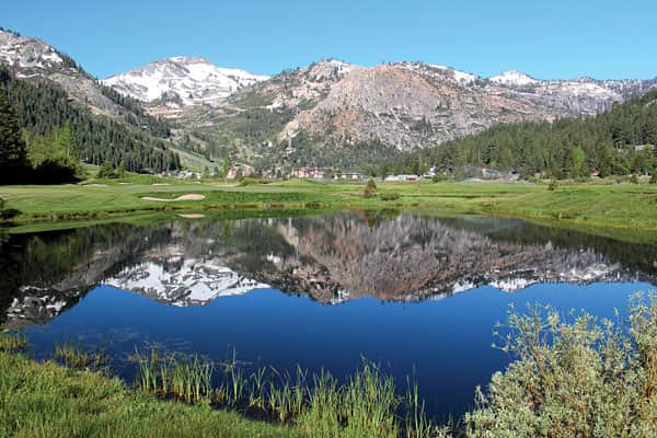
The 2015-16 winter season recharged the watershed. | Mark McLaughlin
For all intents and purposes, the highly publicized ENSO-influenced winter of 2016 is over. Officially, we won’t know the final outcome until Sept. 30, which is when the 2016 water year ends in the Sierra Nevada. But statistically, it is unlikely that the Tahoe Sierra will pick up much additional precipitation over the next three months.
[blockquote3]
“The topsy-turvy aspect of the precipitation pattern also showed the unpredictability of our climate here in the Tahoe Sierra.”
[/blockquote3]
As the strong and intense El Niño built strength throughout the summer and fall of 2015, weather forecasters were robustly confident in their near-unanimous agreement that much of California was likely to be wetter than normal, especially the southern portions of the Golden State. By many metrics, the positive ENSO (El Niño) event last winter was the strongest ever recorded, but it confounded predictions. Instead of a wet south and dry north, the inverse occurred and Northern California and the Pacific Northwest were hit with the bulk of rain and snow. Southern California was supposed to be in the bull’s eye when it came to rainfall last year, but it was a disappointingly dry winter at only 55 percent of average.
Portions of Northern California were blessed with up to 120 percent of its normal precipitation, which helped replenish important reservoirs in that region. Statewide reservoir storage is up to 90 percent, a big jump compared to 55 percent in 2015. The Northern Sierra 8-Station Index, which averages precipitation totals from weather stations that range from Placerville to Mount Shasta, currently indicates 57 inches of precipitation so far, about 7 inches more than average.
But much of the state is still in extreme to exceptional drought, the highest categories in the U.S. Drought Monitor. After last winter, the Tahoe Sierra region’s water situation improved, but we are still dry compared to historic norms. North Lahontan, the hydrological region that encompasses Lake Tahoe and the Truckee River system, ranks lowest in reservoir storage in California, primarily due to low water levels in Big Blue. Despite its impressive natural beauty, Tahoe is operated as a reservoir and it has room for much more water than it currently holds. (See Sightseeing in every issue for current water levels on Lake Tahoe and in area reservoirs.)
Winter 2016 started off strong and early snowfall enabled Truckee-Tahoe resorts to open terrain for the traditional opening weekend of Thanksgiving. The first major winter storm struck on Dec. 11, bringing Squaw Valley’s upper mountain snowfall to more than 7 feet for the season. A second vigorous front hit 10 days later, delivering more rain and snow. Wind gusts reached 129 mph at the top of Mammoth Mountain. Best of all, the storm poured more than 6 billion gallons of water into Lake Tahoe in less than two days. By New Year’s Eve, the Tahoe Sierra snowpack ranged from 5 to 8 feet deep with 136 percent of average water content. At Squaw Valley, it was only the fifth time in the resort’s 60-year history that it was able to open all of its terrain by Christmas Day.
Frequent storms in January maintained the above-average snowpack along with excellent skiing and riding conditions at Tahoe resorts. The month ended with a powerful Pacific system that slammed the Sierra with up to 2 feet of fresh snow. The low-pressure cell intensified over Southern Nevada, a transition known as a Tonopah Low. The counter-clockwise flow of this atmospheric feature slams the eastern slopes of the Sierra, instead of the usual trend toward more precipitation on the western portion of the range. High winds and heavy snow in Nevada generated blizzard conditions that shut down Interstate 80 west of Reno in the Truckee River Canyon.
By Feb. 1, the Tahoe Basin snowpack was about 130 percent of its normal water content for that time of year. But the month of February turned into a bust with little additional precipitation during one of the normally wettest months of the year. By the end of February, snowpack levels had fallen to just about normal. The lack of mid-winter precipitation, while not uncommon, was another indicator that El Niño events are unpredictable, no matter what their strength.
Fortunately, a robust storm pattern in March turned things around dramatically. The snowpack soared in the higher elevations and Shasta Reservoir, California’s largest, captured 1 million acre feet of water in just two weeks. Squaw Valley picked up enough snow that spring to stay open until Memorial Day weekend.
Squaw Valley Ski Resort’s Snowfall Tracker indicates that 21 feet of snow fell on its lower mountain at 6,200 feet that season, while at 8,000 feet the slopes picked up nearly double that with 41feet — about 44 inches above average. These modest numbers in no way denote an epic snowfall last year, but skiing and riding conditions were the best since the Top 10 winter of 2011.
Up to this point in the 2016 water year, from Oct. 1 to Sept. 30, Randall Osterhuber at the Central Sierra Snow Lab near Donner Pass has tallied 376 inches of snowfall and 67 inches of precipitation (rain combined with the water content in snow). The Snow Lab is located at 6,900 feet. Typically elevations higher than that level receive significantly more snow.
The 31 feet of snow recorded at the Snow Lab is about 10 percent below its annual average of nearly 35 feet. That ranks 2015-16 at No. 64 out of 137 years of measurements. Precipitation, however, was much more generous. The 67.2 inches of water so far ranks 2016 at No. 33 since 1871.
There is no doubt that the media-hyped El Niño did influence our winter weather as the season was warmer and wetter than normal, a classic signature. But the topsy-turvy aspect of the precipitation pattern also showed the unpredictability of our climate here in the Tahoe Sierra. What’s in store for next winter? A negative ENSO, or La Niña, is looking likely. Stay tuned.
Tahoe historian Mark McLaughlin is a nationally published author and professional speaker. His award-winning books are available at local stores or at thestormking.com. You may reach him at mark@thestormking.com. Check out his blog at tahoenuggets.com or read more at TheTahoeWeekly.com.


