


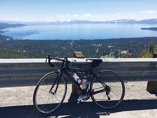
How does a ride on 16 miles of beautiful smooth pavement with a wide bike lane sound? Nice, eh? For an added bonus, there are unbeatable views of Lake Tahoe and some of the Tahoe area’s highest peaks. Now that you are excited, I should add a disclaimer that there is one little hill. That climbs to 8,900 feet. What is this amazing ride? It’s a place thousands of cars pass by every day: Mount Rose Highway from Incline Village, Nev., to the Mount Rose Pass.
Around the bend the climb continues with views of Rose Knob Peak, the Tahoe Rim Trail clinging to its face on your left and a thick forest of red fir and lodgepole pine on your right.
Mount Rose Highway — aka State Route 431 — is a go-to ride for those looking to get in a two-hour workout close to Tahoe. I’ve ridden it about a half dozen times, including in February in the midst of our long lull without snow. While 8 miles of climbing is tough, it’s a fairly gentle grade. Just put it in your lowest gear and keep pedaling. The biggest challenge for me might actually be the 8 miles of downhill when my hands cramp up from keeping a death grip on the brakes. This is more of a problem early season when there is still sand in the bike lane, so you will want to keep your speed well under control.
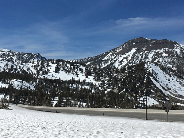
Some folks don’t seem to have much problem with that big downhill like my riding buddy Dana Ash. She says: “The Mount Rose Highway is one of my favorite local rides for the workout it offers with a solid, steady climb up 2,500 feet from the lake to the highest year-round Sierra pass. The views are fantastic the whole way and although it can be a busy road, there is a generous shoulder most of the way.” (She didn’t even mention the downhill because she barrels down it fearlessly.)
You can start the ride anywhere in Incline Village. I drive up from the roundabout where State Route 28 and 431 meet, continue up SR431, past the two churches on the right and park in a pullout along the road about a half mile from the roundabout. Once you begin to ride, in fairly short order you will see a Scenic View 2 Miles Ahead sign and you will discover that distance is relative. In first gear on this climb, 2 miles is one hell of a long way, but eventually the road arrives at the big curve in the road where the view is located. Stop and catch your breath, take a photo, because no matter how many times you see this view it never loses its appeal. And it is certainly most appealing as an excuse to take a break on this ride.
Around the bend the climb continues with views of Rose Knob Peak, the Tahoe Rim Trail (TRT) clinging to its face on your left and a thick forest of red fir and lodgepole pine on your right. At about 8,000 feet, views open to the west of the lake, but save those for the ride back down when you will be looking directly at the lake.
At about 5 miles from the start, the road veers to the east and the grade seems to increase a bit as unseen on your left you pass the meadow formerly known as Incline Lake. High above to the north sits Relay Peak, the highest spot on the TRT. Eventually, finally, the road levels off for a short distance at the lushness of Tahoe Meadows.
Only 1 mile more of climbing to go, but that 100 yards of coasting was a welcome respite and perhaps an excuse for another photo. Keep on trucking past the TRT South trailhead on your right, to the Mount Rose/TRT North Trailhead at the 8,900-foot summit. Here at your turn around spot there’s a restroom — but no water — and parking. You also get a chance to see the dramatic face of Mount Rose itself high above to the northeast.
Now it’s time for the downhill back to Incline — or you could go for Option B: Have someone pick you up on his or her way back from Reno, so you don’t have to go flying back down the hill, unless you like to speed. In that case, you will enjoy the long downhill. Watch for obstacles and the rumble strip between bike lane and road as you descend. I usually have to stop a few times to give my arms an overhead stretch and release my brake-cramping fingers. Fortunately, the views of Tahoe and the mountains are always worth a stop.


