


April is a seasonal transition month in the Sierra Nevada. While the ski areas are beginning to wind down, there is still too much snow to get out onto most of the hiking trails around Tahoe. Itching for dirt, it’s a time when locals head out of town to the coast for the smell of the ocean or the foothills for warmth and wildflowers.
But just a quick hour drive from Tahoe, on the other side of the Carson Range, dirt is already available for your hiking boots or mountain bike tires. And it’s not just desert dirt, but that under the sweet smelling pine trees dirt, as well. Here are a few recommended spots to explore in Reno and Carson City.
Reno trails
Just off the Mt. Rose Highway, where the desert meets the mountains, an extensive networks of trails extend out from the Galena Creek Visitor Center and the appropriately named Timberline Drive. These trails are part of the Galena Creek Recreation Area and sit just a few miles above the edge of busy southwest Reno but quickly brings hikers or bikers into the remote edge of the Carson Range. The trails provide a series of interesting loops, as well as an extension all the way into the Mt. Rose Wilderness and eventually the Tahoe Rim Trail.
Thomas Creek Trail and White’s Creek trails both head west from Timberline Drive toward the Sierra. The Thomas Creek Trail eventually becomes the Rim To Reno Trail, which covers 21 miles going all the way to the Mt. Rose Trailhead of the Tahoe Rim Trail. It includes more than 5,000 feet of climbing and spends a good portion of the route above 9,000 feet: Not a good choice for April (go in July for amazing wildflowers), but there is plenty of dirt to be had now on a series of loops that form the lower portions of the trail system.
Galena Creek Recreation Area
Bitterbush Trail | .4 miles, Easy
Galena Creek Nature Trail | 1 mile, Moderate
Jones Creek Loop | 1.7 miles
Jones-Whites Creek Loop | 9.2 miles, Strenuous
Upper Thomas Creek Trail | 1.5-3.9 miles (one way), Strenuous
Upper Whites Creek Trail | 1.2 miles (one way), Moderate
Visitor Center Interpetive Trail | .4 miles, Easy
Carson City trails
Ash to Kings Trail | 7 miles, Moderate
Clear Creek Trail | 18 miles (one way), Moderate-Strenuous
North Kings Loop | 1.7 miles, Moderate
Upper Waterfall Loop | 4.4 miles, Moderate
Waterfall Trail | .6 miles roundtrip, Easy-Moderate
The Galena Creek Visitor Center is up the road another two miles or so from Timberline and provides access to the Jones Creek and White’s Creek loop trails, which you can loop back to the Thomas Creek and White’s Creek Trailhead. These trails are popular with both hikers and mountain bikers.
Hikers can take the Jones-White Creek Loop which is a hearty 9.2 miles, or a White’s Creek/Dry Pond/Thomas Creek Loop that comes in at about 5 miles, plus a short walk or ride between the two Timberline Trailheads. If you just want a quick leg stretch, there are also several short jaunts in the vicinity of the Visitor Center.
The lower portions of most of these trails allow bikes, but as you climb, eventually you reach the Mt. Rose Wilderness Boundary, where biking is not allowed. While the distance available for riders is less than hikers, riders should still be able to find lots of good riding to blow away the winter cobwebs. Be sure to pick up a copy of a map at the Visitor Center or check out the website galenacreekvisitorcenter.org.
Carson City trails
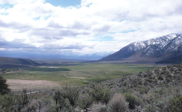
The Clear Creek Trail climbs 18 miles from Jacks Valley Road, just south of Carson City, to Spooner Summit. I wrote about the top few miles out of Spooner Summit last year (available at TheTahoeWeekly.com) but in April, you will want to start at the other end. The trail begins in the high desert sage, soon providing a great view of Jacks Valley and distant Job’s Peak, before climbing into the trees. It continues to climb with rolling, winding switchbacks for about 7 miles to what is called the knob view, a good turn around point. If you are hiking, you will probably turn around sooner. This trail was constructed by the Carson Valley Trails association, find out more about the trail and the association at carsonvalleytrails.org.
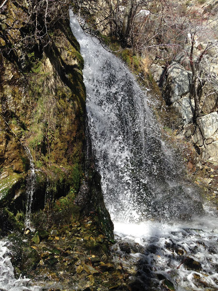
The Ash To Kings Trail was built in 2015 and provides 7 miles of single track on the open slopes just to the west of Nevada’s capital. The trail crosses Ash Canyon Creek and provides smooth single track climbing. There is a nice overlook of the city, and then the trail winds its way to Waterfall Road where you can join the 4.4 mile Waterfall Loop and North Kings Loop trails off Kings Canyon Road.
Combining all the trails would make for a lengthy jaunt, hikers might prefer the shorter North Kings Loop and the first few miles of the Ash to Kings Trail that is also knowns as the Overlook Trail. For information and a map go to musclepowered.org.


