


Story & photos by Tim Hauserman
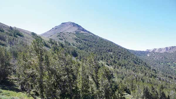
Mount Rose Wilderness on the Rim to Reno Trail looking back at saddle with slope of Mount
Mount Rose trailhead to Thomas Creek
21 miles one way
Moderate to strenuous at high elevation
[blockquote2]
“The open, sagebrush-covered slopes provide ample opportunity to enjoy the views of Bronco Canyon, the backside of Mount Rose, Church Peak and Mount Houghton.”
[/blockquote2]
The Rim to Reno Trail (R2R) ranges in elevation from 5,900 feet to just shy of 10,000 feet as it travels through the heart of the remote Mount Rose Wilderness. Twelve of the trails 21 miles pass through the rarified air above 9,000 feet. Each end of the trail can be quite busy, but the great bulk of your hiking is spent on trail that is so seldom tread upon that your walking on it is doing a public service by keeping the trail from disappearing.
Completed in 2012, the Rim to Reno Trail connects the Tahoe Rim Trail’s trailhead at the top of Mont Rose Summit (8,900 feet) to the busy Thomas Creek network of trails on the Galena outskirts of Reno, Nev., at 5,990 feet. A shuttle is highly recommended and an early morning start at the 3,000-foot higher Mount Rose trailhead is advised.
While the first 4 miles out of Mount Rose are quite popular, an early morning start will probably leave you with the trail to yourself. And, what a first 4 miles it is: Spectacular views of Lake Tahoe, Mount Rose and Galena Falls. The trail climbs to the junction where the R2R goes straight ahead, and the Mount Rose Trail goes to the right. A dramatic downshift in trail usage immediately becomes evident. You are leaving one of the busiest sections of trail in Nevada, and about to enter one of the least-used sections of major trail anywhere near Lake Tahoe.
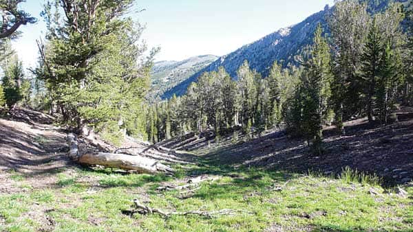
Mount Rose heading down toward Bronco Creek
The R2R meanders down into a lovely bowl with scattered lodge pole and white bark pines. Keep your eyes peeled, as the trail is faint in places. The steep, rocky slopes of Mount Houghton, Mount Rose’s 10,490-foot neighbor, rise high above to the left. The descent ends at Bronco Creek, a sparkling, swiftly moving little stream in the spring and early summer. If camping is on your mind, the next water you will find is Thomas Creek, just a few miles before the route ends. After a dry year like the past one, however, it might not be running this late in the season. I did the hike in July and the creek was a lovely bit of wetness surrounded by wildflowers.
After Bronco Creek, a long, gentle ascent heads up to a 9,700-foot high ridge. The open, sagebrush-covered slopes provide ample opportunity to enjoy the views of Bronco Canyon, the backside of Mount Rose, Church Peak and Mount Houghton.
The trail rounds several rocky outcroppings, each with another fine vista, before setting out on a long traverse north through a dense forest. While not my favorite part of the hike, you will enjoy this peaceful, high elevation meditative stroll through ancient trees. Eleven miles into the hike is a junction. Both directions head toward the Thomas Creek trailhead, but the North Loop adds an additional 2 miles to the journey.
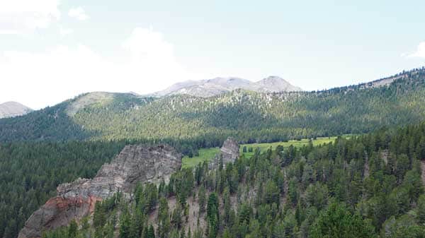
Volcanic rock formations at the headwaters of Thomas Creek.
On the South route, the trail switchbacks to the sharp-edged crest. From the crest, Reno is now in sight, as well as the challenging 9 downhill miles you still have to hike to get to where the forest meets the desert at the Thomas Creek trailhead. The route begins with a steep set of switchbacks, and you thanking your lucky stars that you remembered to bring your hiking poles.
Three miles from where they parted, the North and South loops join and the descent continues through wildflowers and sagebrush. The views of immense volcanic rock formations and aspen groves along the headwaters of Thomas Creek hopefully assuage your now-tired legs. Eventually, you get close enough to hear Thomas Creek as it takes a long, slow journey through aspen groves and pine trees to the trailhead.
What to pack
Hiking poles are a must. Twenty-one miles is a long way, and with about 9 miles of steep downhill, almost every hiker’s knees could use the break. Bring lots of water, food and a good supply of layers as the wide variation in elevation and length of the hike require an early start and late finish.
The Tahoe Rim Trail-Mount Rose trailhead is located at the top of the Mount Rose Highway (431), 8 miles east of Incline Village. The Thomas Creek trailhead is located on Timberline Drive off Highway 431, about 1 mile east of the Galena Creek Visitor Center in Reno.


