


After four consecutive winters with less than average precipitation — especially 2014-15, the least snowy of record — it’s nice to see the Tahoe Sierra back in the saddle again weatherwise. It has not been an exceptional winter so far, but with Tahoe Basin precipitation closing in on 120 percent the region is off to a great start. The frequent, but generally moderate, storms have been exactly what we needed.
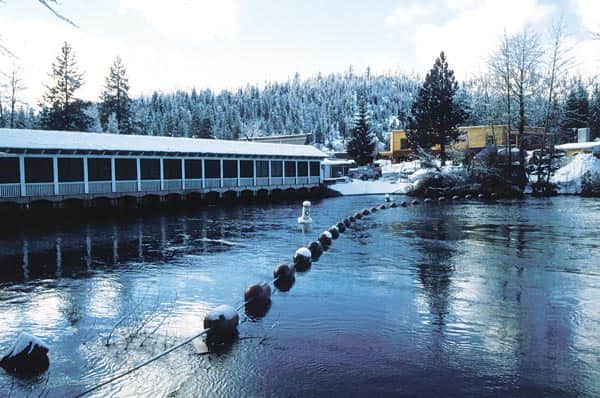
In January 1997, Lake Tahoe’s water level exceeded it maximum legal limit. | Courtesy Mark McLaughlin
The current El Niño event in the Pacific Ocean is rated exceptionally strong, but the storm pattern so far has thrown scientists a curve ball. Seasonal forecasts called for drier than normal conditions in the Pacific Northwest and wetter than normal in Southern California. Los Angeles has been impacted with storms this winter, but precipitation there is running half of what it was at this time during the last very strong El Niño in 1997-98. And the Pacific Northwest is above average for rain and snow. Go figure.
[blockquote3]
“The 1997 flood is by far the worst on record on the Carson, Walker and Truckee rivers.”
[/blockquote3]
Each year has its own unique character; you never know what may happen. Ten years ago, the winter of 2006 was off to a slow start, but things picked up in the second half of December 2005. Tahoe resorts picked up nearly 10 feet of new snow in the upper elevations in late December 2005, setting the stage for a good ski season.
Sugar Bowl’s upper mountain base grew to nearly 8 feet deep. Mammoth Mountain’s pack doubled from 6 feet to 12 feet between Christmas and New Years. On New Year’s Day, Mammoth picked up 55 inches in just 24 hours. Kirkwood Mountain Resort, where 24 feet of snow had been tallied so far, boarders were riding on a pack 14-feet deep.
But when the freezing level rose to nearly 9,000 feet at times, hydrologists issued flood warnings. The highest elevations were hammered with Sierra cement, but rain often dominated below 7,500 feet. Mild, moisture-laden Pacific storm systems like that can cause significant flood problems. During the Christmas holidays of 2005, forecasters were greatly concerned that the heavy rain would rapidly melt the snowpack and flood the Truckee River. That’s what happened in the New Year’s Day flood of 1997. The river did go on a rampage in early January 2006, but it was nowhere near as catastrophic as the ‘97 event.
The 1997 flood is by far the worst on record on the Carson, Walker and Truckee rivers. The ’97 event caused $1 billion damage, but miraculously there was only one fatality. This type of winter flood is called a wet mantle event because prolonged heavy rain at high elevations melts the mantle of snow on the mountains and the subsequent runoff overwhelms streams and rivers.
Forecasters are expecting increased precipitation this winter due to the El Niño-influence on weather patterns, with a probable uptick in atmospheric rivers, the new name for so-called Pineapple Express storms. Atmospheric rivers focus heavy moisture surges into the West Coast that can deliver up to half of our winter precipitation. Although flooding is expected at times over the next few months, especially in Southern California, no one can say whether the mountains will experience a wet mantle event this season.
Reservoir and watershed conditions usually determine the likelihood and severity of a winter flood. There were several factors in 2005-06 that reduced the threat of a disastrous flood like what occurred in 1997.
First, in 1997, the two previous years (1995 & 1996) had been extremely wet and Lake Tahoe’s water level was within 12 inches of its legal maximum of 6,229 feet in elevation. There was little room for additional water storage in the lake. That was not an issue in 2005-06, nor would it be this year.
Second, a major, cold winter storm on Dec. 21 and 22, 1996, had dumped heavy snow in the Sierra (about 6 to 7 feet at lake level) and up to three feet in the valleys of western Nevada. This set up a deep, unconsolidated early season snow pack.
Third, a vigorous atmospheric river driven by a strong subtropical jet stream pushed heavy rain into the Sierra at the end of December 1996. Freezing levels soared to 11,700 feet on Jan. 1, 1997. There was an incredible amount of runoff pouring out of the Sierra Nevada from Dec. 30 to Jan. 6, 1997. At Blue Canyon, nearly 19 inches of rain fell in three days. Precipitation totals in the Feather River drainage exceeded 35 inches. Squaw Creek went on a rampage and caused substantial structural damage in Olympic Valley.
Fourth, on Jan. 1, 1997, Lake Tahoe’s water level exceeded its legal maximum limit, which forced Federal Watermaster Garry Stone to fully open all 17 gates in the Tahoe Dam. The resulting surge of water contributed to the inundation of the Truckee River floodplain from Squaw Creek to beyond Reno. Nearly every bridge across Highway 89 between Tahoe City and Truckee was destroyed or seriously damaged. Damages in the upper Truckee River watershed reached $11 million. In several eastern Sierra watersheds, the 1997 runoff exceeded 100-year flood flows.
Another significant difference between the December 2005 precipitation event and 1997 was the orientation of the jet stream. Instead of the deep, subtropical nature of the 1997 storms, the systems in late 2005 were caught in a strong zonal flow that did not tap as much tropical moisture. The storms themselves were lined up to eastern Asia and the Philippines.
The juicy weather systems at the end of 2005 unloaded significant precipitation, but they were not the true Pineapple Express type that taps moisture from Hawaii and beyond, Ski resorts were disappointed that snow levels rose above 8,000 feet at times in 2005, especially during the economically important holiday period, but the heavy, wet snow built a solid base that secured the season for months to come.
The 2005-06 storms did generate the worst flood on the Truckee and Carson rivers since 1997. High water caused millions of dollars of damage (estimated at nearly $3 million in Reno alone), but the region was spared a catastrophic event. On the positive side, the abundant moisture boosted the level of Lake Tahoe. Big Blue’s surface elevation rose nearly 12 inches to 6,225.6 feet in two weeks. We could certainly use some of that this winter.
Tahoe historian Mark McLaughlin is a nationally published author and professional speaker. His award-winning books are available at local stores or at thestormking.com. You may reach him at mark@thestormking.com. Check out his blog at tahoenuggets.com or read more at TheTahoeWeekly.com.


