


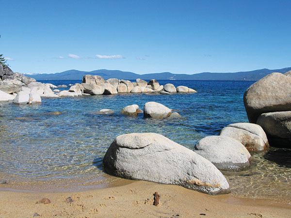
It happens every year in Tahoe — that challenging in-between period after the ski areas close (Squaw Valley is still open), but there is still too much snow to hike and mountain bike. This year, it will be longer than usual before we can get to our favorite spots given the copious quantities of the white stuff that came down in winter. Now is when the inside scoop from an old geezer — I mean, a guy who has been hiking around Tahoe for a number of years — can be helpful in coming up with the best early season hikes around the lake.
First, to start your own list, consider these rules of spring snow melting and apply them to your favorite trail:
- Lower elevations melt faster than higher elevations.
- The west side of the lake gets a lot more snow than the east, so the east side will melt out sooner.
- Sunny, open areas melt faster than shady spots in the trees.
- Southern exposures melt faster than northern exposures.
Of course, it is pretty difficult to find a trail that is low elevation, east side, with a southern exposure and not too many trees, but there are a few that have at least a good dose of these attributes.
ENTER TO WIN!!
- Snap a picture of yourself checking an item off our bucket list
- Include a copy of Tahoe Weekly in your photo to be entered to win
- Post photos on Instagram and tag @TheTahoeWeekly #TahoeBucketList
- We’ll pick our favorites to win prizes
Check these off your bucket list today! #4, #5, #12, #51, #56, #74
Tips for hiking in snow
- Watch for snow bridges and stream crossings under snow. It might look like a lot of snow, but if it is hollow underneath, you will take a big drop into the drink. If walking on snow, look for packed-down sections and keep your eye open for stream pathways.
- Trails might be hard to follow if the snow is still deep. It’s best to hike trails you are familiar with.
- Carry a map and compass, and yes, people still use them. In fact, some of us think they are fun.
- Bring plenty of water and food, water-resistant boots and an extra pair of socks because if you are walking over snow, you’re gonna get wet.
READ MORE: Tim explores the Rubicon Trail
East Shore
Spooner Summit to South Camp Peak
Find spectacular views on this section of the Tahoe Rim Trail above Tahoe’s East Shore. A 5-mile hike with a steady series of good lake views, brings you to the big daddy of views on the “peak” itself. Why it is called South Camp Peak? I will never know. It is a 1-mile long, open ridge with some of the best views you will find anywhere around Tahoe. The last half-mile before the ridge is a thick, north-facing forest, which holds snow into June, but hopefully it will be packed down by the many hikers who came before you.
Skunk Harbor
This hike is fairly short and after a gentle descent of about 1.5 miles, you come to an old rock house and lovely beach — or given how high the water is these days, a lovely sliver of a beach. On the way back, you can follow the direct route you came down or wind around Prey Meadows, which might already be sprouting some flowers.
North Shore
Tahoe Rim Trail | Tahoe City
The first few miles of the TRT heading north from Tahoe City is south facing, exposed to the sun after recent tree thinning and starts out just a bit above lake level. At 1 mile in you get a great view of Lake Tahoe and the bustling Truckee River. The trail then winds atop the Truckee River canyon providing magnificent views of some enormous incense cedars and sugar pines. A particularly lovely view of Twin Peaks and the river far below can be found after 3 miles of hiking. This might make a good turn-around point, because soon after the trail heads away from the river corridor and into a thick forest that will hold the snow for much longer.
South Shore
Tallac Historic Site & Taylor Creek
While it’s more of a stroll than a true hike, the Taylor Creek area gives you a chance to stretch your legs in the sunshine in a spectacular and varied setting. The low elevation and open woods make this an early-bird choice. Enjoy the marshy and riparian areas along Taylor Creek, then take a stroll along Baldwin and Kiva beaches. Just above them, you find the Valhalla and Tallac Historic Site where beautiful old buildings are used for a variety of events, including the annual Word Wave writers’ conference. Can’t make it in the spring? Come back for the Kokanee Salmon run in Taylor Creek in the fall.
West Shore
Meeks Bay Trail
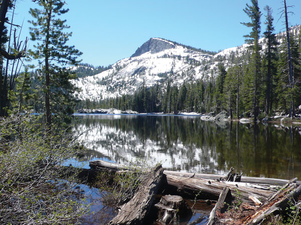
The trail from Meeks Bay to Crag Lake is the first route into Desolation Wilderness to emerge from the snow, usually several weeks sooner than the trails further south heading out of Emerald Bay. It’s just less than 5 miles of moderate hiking to Crag, a lovely mountain lake at the base of it’s craggy namesake peak. The more ambitious can press on for another 1.5 miles to Stony Ridge Lake, another Desolation gem.
Vikingsholm & Rubicon Trail
With south-facing exposures and near lake-level altitudes this hike opens up fairly early, but we are still talking the West Shore, so a lot of snow needs to melt. You can start at the Vikingsholm parking lot and head down to Vikingsholm and Eagle Falls, which will be roaring this year. Once you’ve been doused in mist by the falls, take the Rubicon Trail to the entrance of the bay, about 1.5 miles from Vikingsholm. The Rubicon Trail continues north for 3 miles along Tahoe’s shore to Calawee Cove in D.L. Bliss State Park. Hopefully you will be treated to views of both eagles and osprey that nest in the area. Try to get on this trail in early June before the summer crowds arrive.
Other possibilities if you don’t mind wet shoes and socks include Marlette Lake Trail or Spooner to Snow Valley Peak and the TRT, both on the East Shore, or Brockway Summit to Martis Peak Road crossing on the North Shore.
Don’t even think about it until July
These trails will not be accessible until July: Desolation Wilderness trails out of Emerald Bay and Echo Lake, Mount Judah Loop, the Pacific Crest Trail or other trails on Donner Summit, TRT from Ward Canyon to Desolation Wilderness and Carson Pass to Showers Lake.
For more trail information, visit tahoerimtrail.org.


