


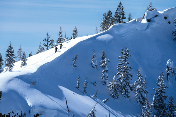
As skiers head into the backcountry this winter, Tahoe Weekly caught up with members of Tahoe Backcountry Alliance to get the skinny on current developments in local winter recreation access.
“We are kind of in a holding pattern while Tahoe Regional Planning Agency and the Forest Service work on their regional trails plan,” says TBA executive director Anthony Cupaiuolo. “We are also engaging with Tahoe Conservancy as they are in the middle of creating a recreation access plan with some of these parcels that go up against Forest Service land and have the potential to be a trail access point. We want to see safe, legal parking, however it happens.”
“When we formed in 2015, we had a pretty narrow lane and that was trailhead access. As we’ve matured as an organization and tasted some success, we’ve expanded our vision of access. It should go beyond the trailheads. Access should also mean all people in our community should have access to winter backcountry recreation experiences.” – Geoff Quine
It was changes to roadside parking near Jake’s Run overlooking Emerald Bay on the West Shore that prompted the creation of the Alliance in 2015. After gaining grassroots support, they were able to negotiate changes to the highway department’s plowing practices to increase winter parking access after an erosion control project along Highway 89 eliminated many parking areas once used by backcountry skiers.
Lake Run access success
Two years ago, Tahoe Backcountry Alliance partnered with Truckee Donner Land Trust, Visit Truckee Tahoe and Town of Truckee to expand winter parking on South Shore Drive for access to Donner Lake Run. This historic backcountry ski route descends from the summit of Mount Judah high on Donner Summit to the neighborhood surrounding the lake. TBA paid to have the West End Beach parking lot repaved and all agencies split the annual cost of snowplowing, which is more than $10,000. Last year, TBA installed signage with QR codes linked to online maps at the parking lot and directional signs along the main line of the run.
These efforts aimed at minimizing conflicts between skiers and property owners have largely been a success. The joint investment represents a win for backcountry access and the type of creative collaboration TBA is hoping to repeat in its ongoing meetings with Tahoe Regional Planning Agency, the U.S. Forest Service, Tahoe Conservancy and countless other land holders in the region.
Seeking more parking solutions
Some of the popular backcountry zones on TBA’s radar are Rubicon Peak, Trimmer Peak, Echo Peak and Flagpole Peak. What these trailheads have in common is they are all public lands that rise out of neighborhoods, which has led to ticketing and towing during storm cycles. Remedying these parking situations is not cheap. The estimated design and construction costs for a new Rubicon trailhead exceeds $250,000. Similar estimates at Ward Creek are north of $180,000 with maintenance and snow removal costs estimated to total $3,500 annually.
Like at Jake’s, Pole Creek and Deep Creek, parking for one of the Tahoe Sierra’s most iconic backcountry runs at Mount Tallac is set along the shoulder of Highway 89 without an officially designated parking area. Since the Forest Service started closing the gate at Spring Creek Road close to 10 years ago, safety issues have arisen for recreators and challenges for snow-plow drivers, not to mention nearly 2 miles of additional travel through neighborhoods to reach the trailhead.
“The Forest Service is doing a tree-thinning grading project, which I think affords us a chance for a new winter parking lot,” says Cupaiuolo. “We’d love to see parking at the end of the road, but we don’t think that’s realistic. It could be one of those things we don’t get exactly what they want, but we get something. Having safe and legal parking rather than no parking is still a net positive.”
Trail counters map trends
Part of advocating for winter recreation access means having a clear picture of how our public lands are being used. In 2020, Tahoe Backcountry Ski Patrol began to install and monitor infrared laser-counter technology mounted to trees at the primary trailheads for Castle Peak, Incline Peak and later Deep Creek.
Castle Peak is by far the most popular trailhead of the three with a total of 9,961 users between December 2021 and May 2022. Incline Peak counted 995 users and Deep Creek 745 users during the same five-month time span. This is down from a high of 13,386 users at Castle Peak and 2,327 at Incline Peak during the 2020-21 winter season. Deep Creek counters were not installed until last year.
“While there definitely was a pandemic surge, I think some of this can be attributed to the fact that it wasn’t a great snow year,” says Cupaiuolo.
While peak use occurs between 9 a.m. and 3 p.m. on weekends, the counters also recorded steady use on weekdays. Total user amounts are certainly higher than recorded considering those who do not directly pass counters when entering or leaving the area. The counters need to be moved up and down along the tree trunks throughout the season to adjust to changing snowpack levels.
“I feel like backcountry skiers and snowboarders fly kind of under the radar in a lot of ways,” says TBA board member Geoff Quine. “So having this concrete data that we can use to advocate for and push our policy initiatives is super helpful. After we have a significant sample size, we’d like to put together an analysis to be able to quantify how much of an economic impact backcountry skiers have in the area.”
Tahoe Backcountry Ski Patrol has obtained a grant from Tahoe Truckee Community Foundation to install counters at additional sites including Donner Summit, Pole Creek, Tamarack Peak, Tahoe Meadows, Johnson Canyon, Mount Rose Summit and alternate trailheads at Incline Peak and Castle Peak.
Creating backcountry access for all
This year, the TBA has partnered with the Washo Tribe to bring 30 youth out for three days of snowshoeing and cross-country skiing at Tahoe Donner Cross Country Ski Center and Chickadee Ridge on Mount Rose. The outings feature educational components provided by faculty of Tahoe Institute of Natural Science and University of Nevada, Reno at Lake Tahoe.
“When we formed in 2015, we had a pretty narrow lane and that was trailhead access,” says Quine. “As we’ve matured as an organization and tasted some success, we’ve expanded our vision of access. It should go beyond the trailheads. Access should also mean all people in our community should have access to winter backcountry recreation experiences.”
At the end of the outings, the kids get to keep the equipment so they can continue to pursue winter recreation on their own.
“Unlike the other things we are talking about, we can control this,” says Cupaiuolo. “Access should also be about who gets to get out there.”
Microtransit expands
In a bid to highlight the potential for innovative transportation solutions in the region, the TBA’s microtransit program that started in 2019 with three days has now expanded to 20 days.
“We want to showcase to the larger organizations in the region that there’s a need and desire for this and it will be beneficial,” says Cupaiuolo. “We’d love to see South Shore busing up the West Shore to Tallac and Jake’s. We just want to keep that conversation going and keep people thinking about it.”
It costs TBA $1,200 a day to run the free shuttle through Tahoe Sierra Transportation.
Another part of TBA’s mission is spreading the word about proper ethics and etiquette for backcountry winter travel. They hosted a Backcountry Awareness Week in December during which they collaborated with area nonprofits to spread the word about how to recreate safely and respectfully in the backcountry. TBA will also host cleanup days at popular trailheads in the spring.
“We’re pushing that ‘ski kind’ messaging,” says Cupaiuolo. “Park kind, hike kind, be respectful. When you’re parking at 6 a.m., don’t let your dogs run across people’s property. It makes it hard for us to win access when there are negative stories. Being good stewards goes a long way for us to be able to get more wins.” | tahoebackcountryalliance.org
SHUTTLES
WEST SHORE SHUTTLES
Reservations (530) 550-5300, info@tahoesierratransportation.com
From North Shore | Saturdays until March 25; Sundays Jan. 15 & Feb. 19
From South Shore | Saturdays Feb. 4-25
TART Connect
Placer & Washoe counties and Town of Truckee
TART connect app or (530) 214-5811
TRAIL COUNTER DATA
2020-21 2021-22
Castle Peak 13,386 9,961
Incline Peak 2,327 995
Deep Creek — 745


